
Main » Travel
November 22, 2005
Climb Ev'ry Mountain
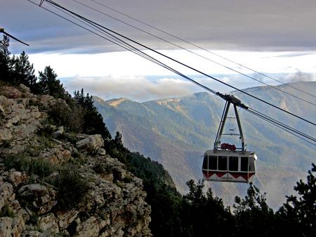
A tram car ascending Sandia Peak outside of Albuquerque, New Mexico. Click the thumbnail image for a larger photo.
November 04, 2005
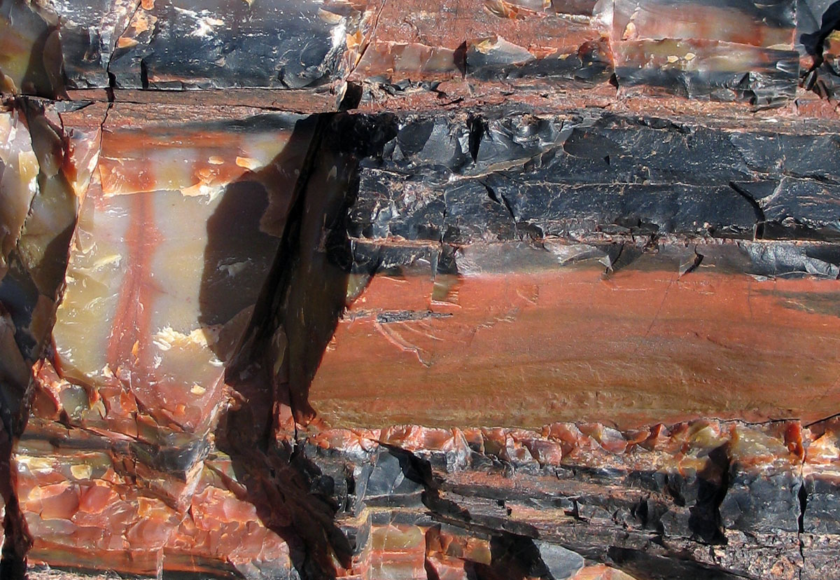
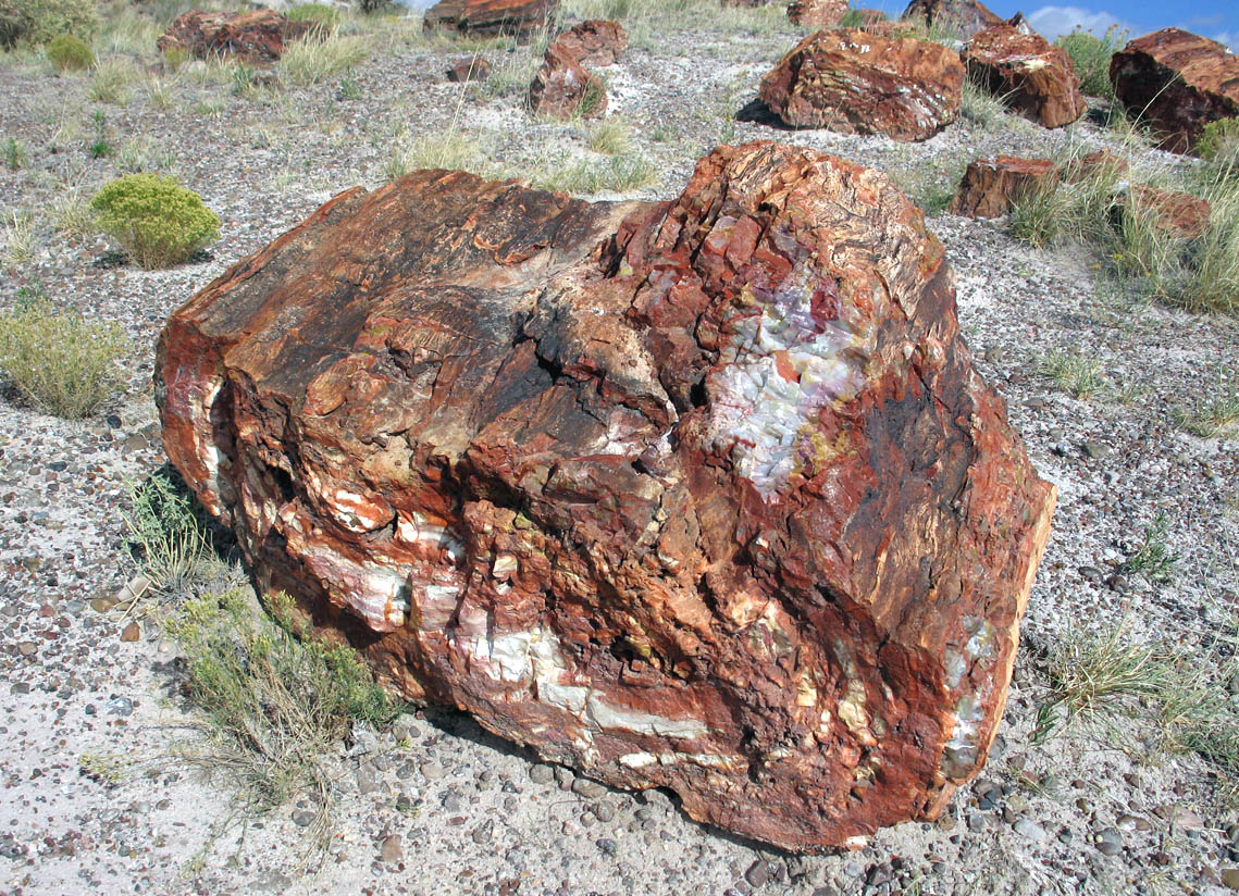
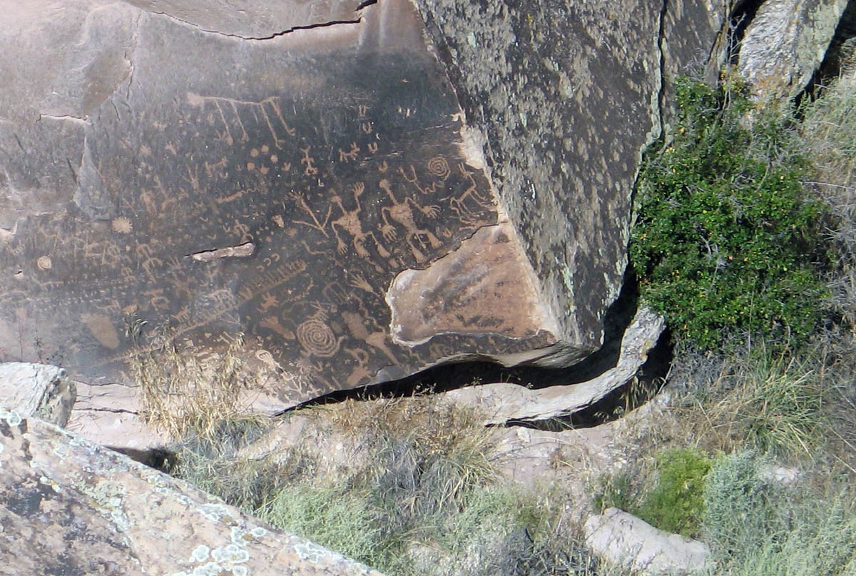
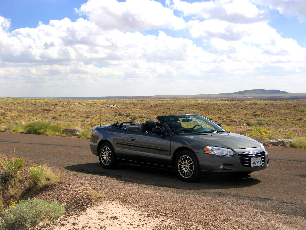
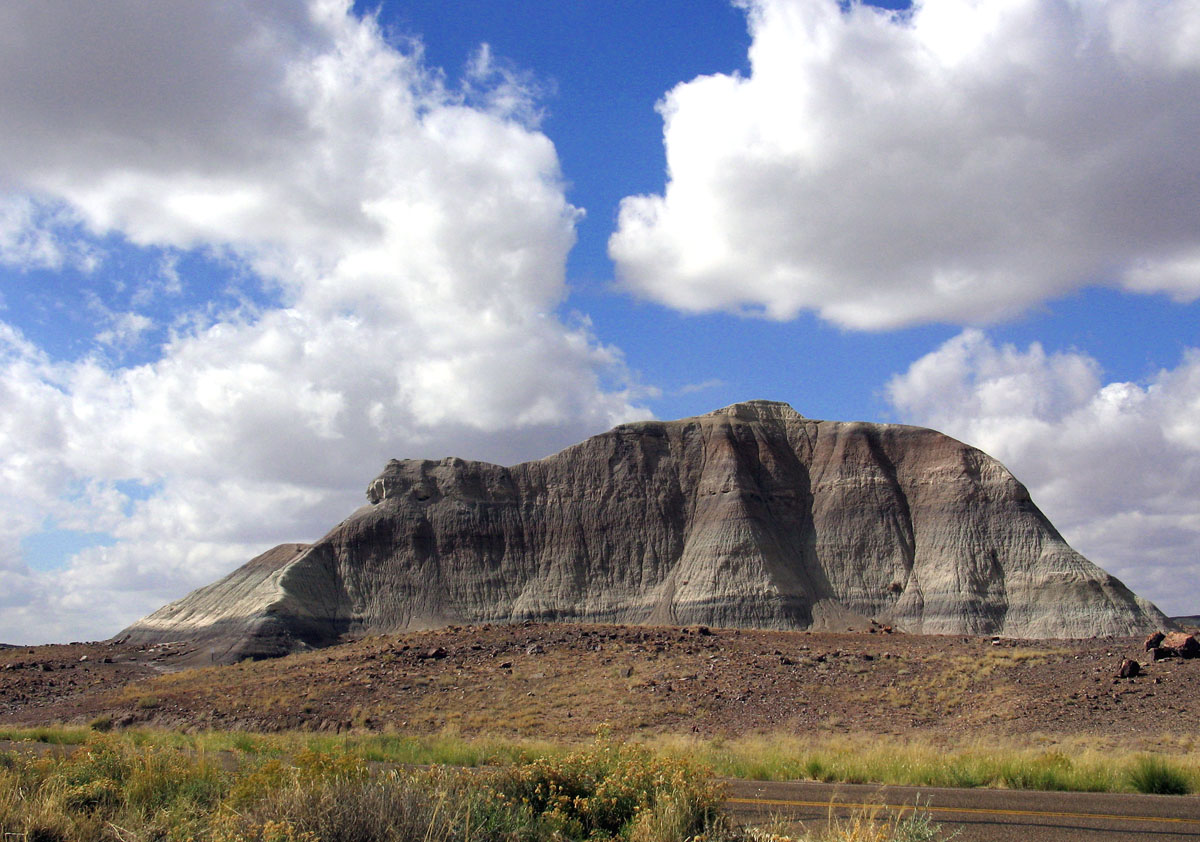
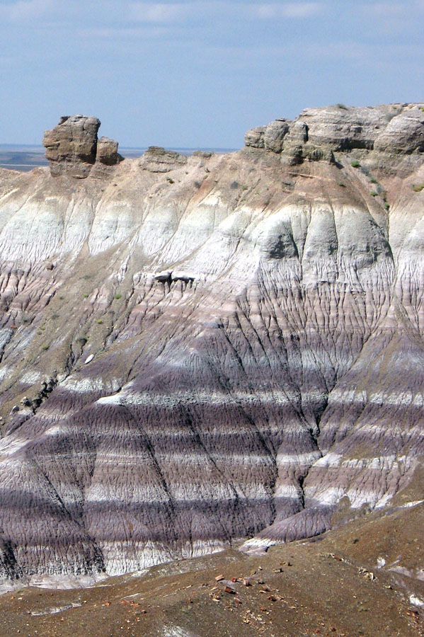
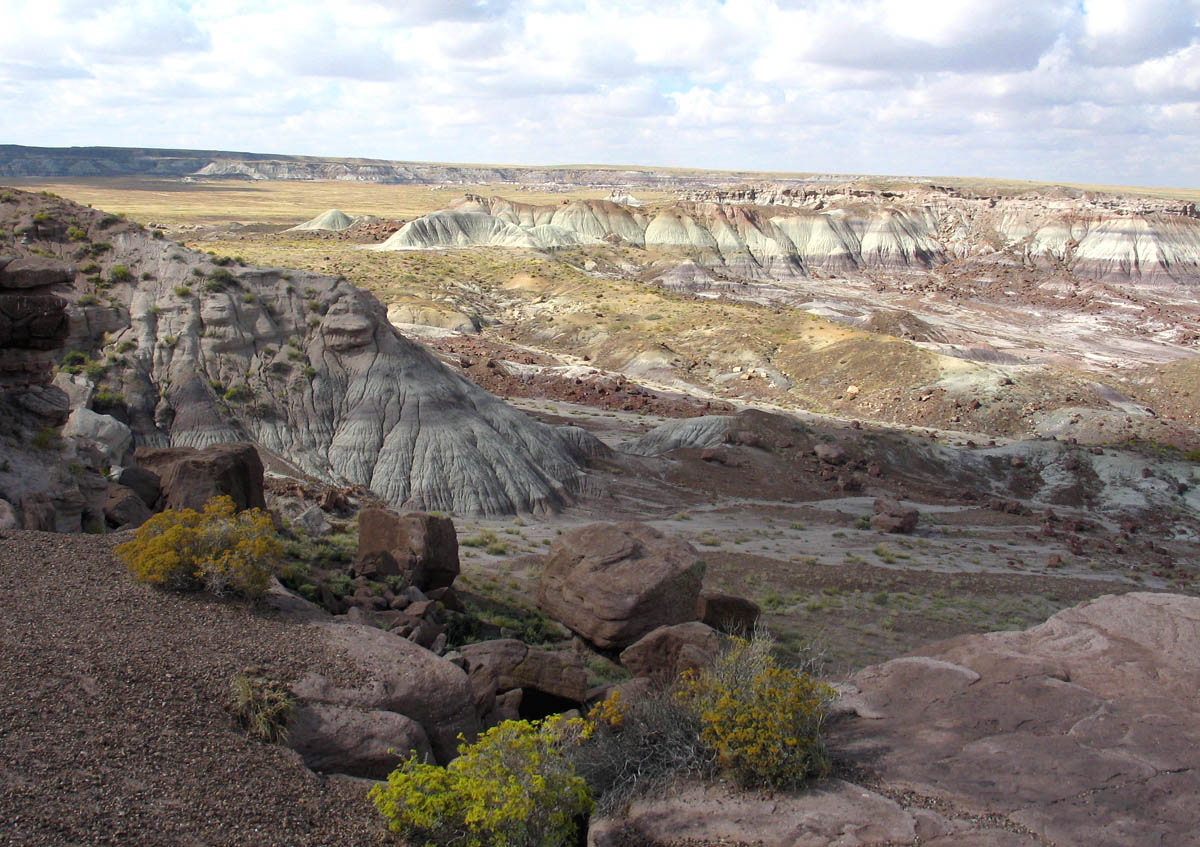
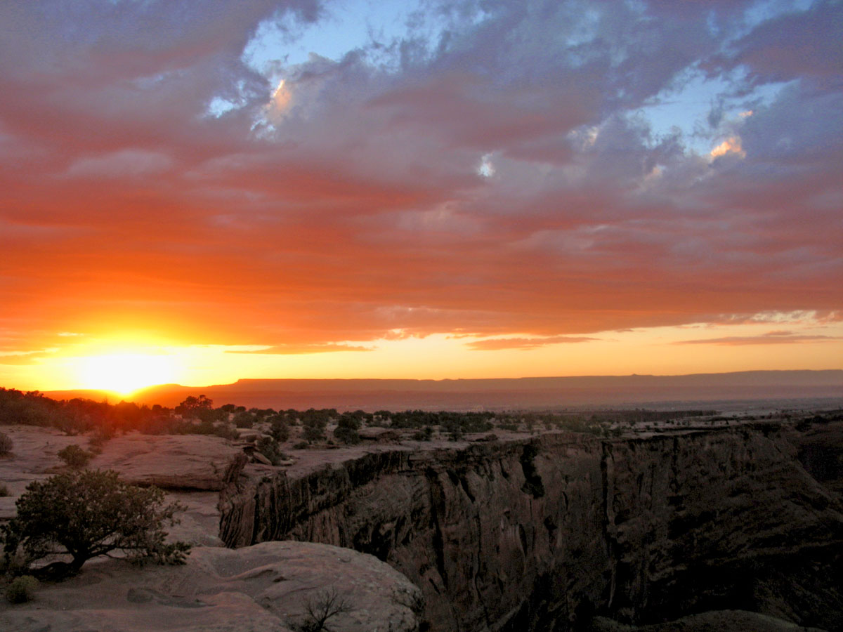
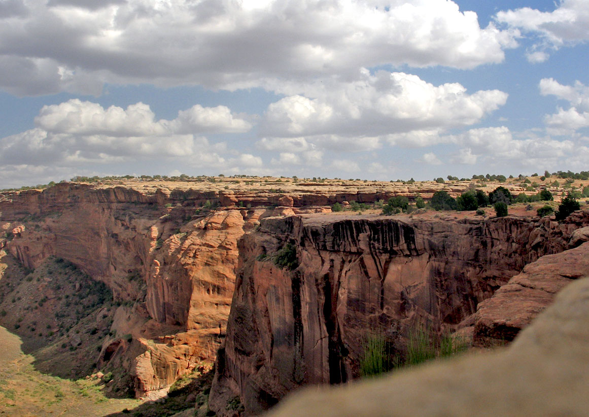
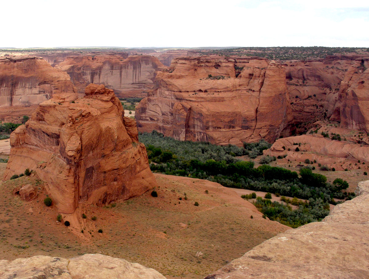
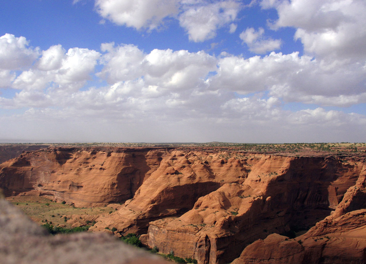
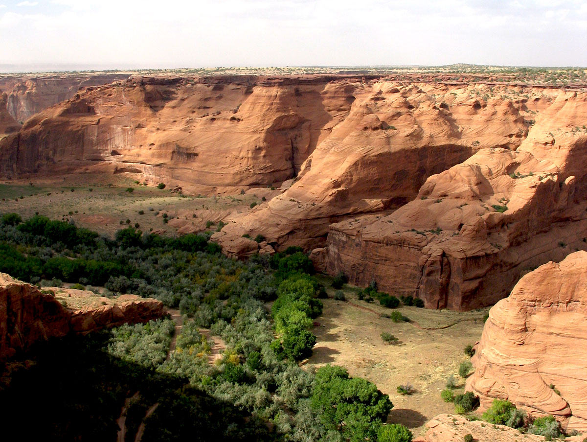
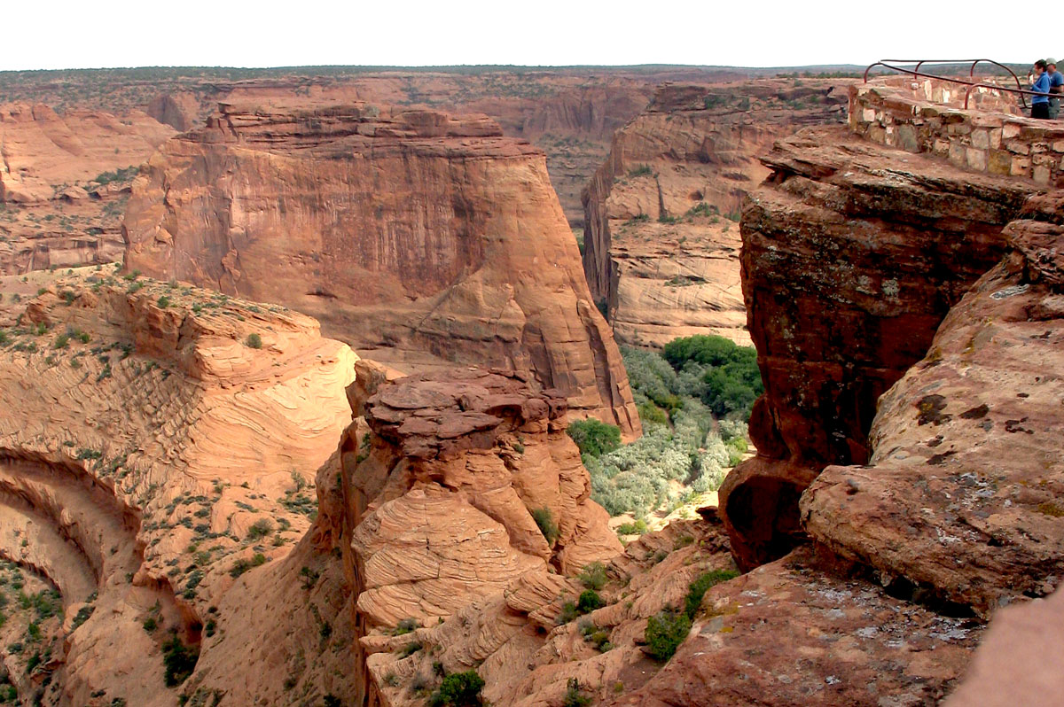
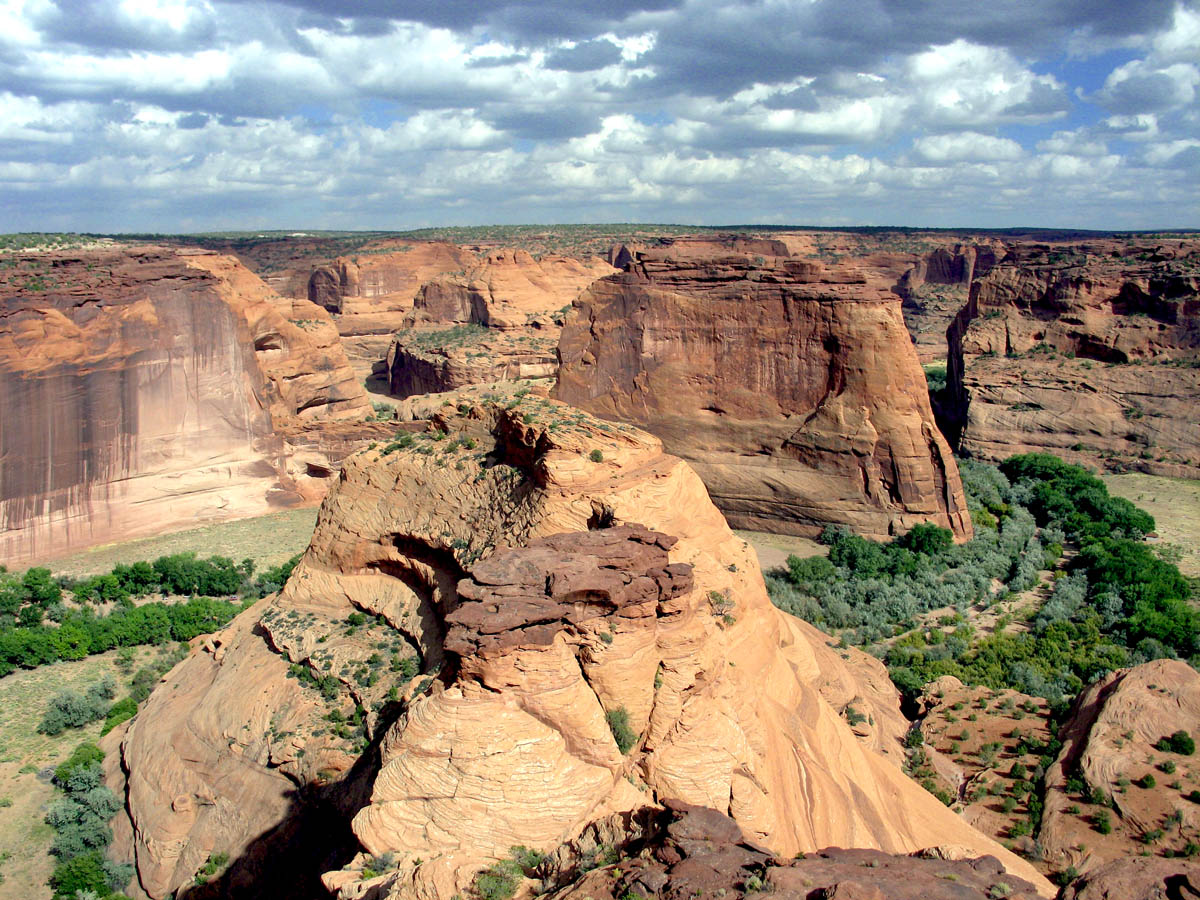
Roadtrip '05 - Day Four - Petrified Forest/Canyon De Chelly
It's really comical how long this is taking me to finish.
Photos for now; writeup to follow.
| 
| 
|
| 
| 
|
| 
| 
|
| 
| 
|
| 
| 
|
| Mouseover the photo for a description; click for full version |
October 27, 2005
Better Late Than ... Really Late
I finally finished my roadtrip journal entry on Day Three - Grand Canyon.
October 13, 2005
Roadtrip '05 - Day Three - Grand Canyon
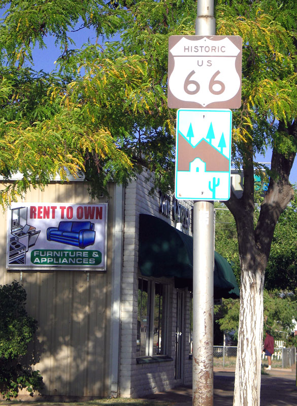
So! We enjoyed a restful night's sleep in the Days Inn Route 66 in Flagstaff. I didn't even hear the trains during the night like I feared I would.
As we were checking out, I asked the desk clerk what was the best (i.e. most scenic) way of getting to the Grand Canyon. She whipped out a map and proceeded to diagram a route, which I only somewhat paid attention to. Trina finished checking out, so I skipped over to the continental breakfast setup and pocketed a container of Frosted Flakes. Just in case.
We stopped for gas, then stopped at McDonalds, then we were on our way on ROUTE 66 (*squeal*) through ... well I don't remember if it was "downtown" Flagstaff, but it was right alongside the railroad tracks, and the visitor center was on the road too. I was even startled by a train that appeared to come out of nowhere and had approximately 1.67 million cars attached to it.
We were squarely caught in morning rush hour traffic, so I whipped out the trusty Rand McNally Road Atlas to check the route I had been given.
As it turns out, the chick was directing us about 20 miles out of the way. She had us driving east, the north, then west. Once I realized that was going to eat up too much time, we backtracked a few miles and took 180 north, then picked up 64 into the canyon itself.
Mike, we didn't stop at the Flintstone thing because even though I begged and begged and begged to stop, Trina was driving and having none of it. We were on a mission, and that mission sadly did not involve Fred or Barney.
However, an interesting thing happened in Valle, Arizona - we were driving behind a slow-moving, dilapidated pickup truck, following at a safe distance. For no reason at all, the man thrusts his left arm out the window and flips us off. It was completely inexplicable, and mostly very weird.
We made sure the doors were locked. Of course, the top was down on the convertible, so ...
Driving, driving, driving, and ... we reach the Grand Canyon entrance. We slap a crisp new $20 into the park ranger's hand, and she gives us two copies of The Guide (the official Grand Canyon publication that lists ranger programs, parking rules, etc.). I had done a lot of online research before the trip and knew the best place to park was at Market Plaza, so we headed there.
At this point, the Grand Canyon looked like any state park you've ever been in. No canyon yet to be seen.
We park, grab our stuff, make a pit stop at the restroom and a pay phone (so I could call La Posada in Winslow to book a room for that night), then catch the free shuttle bus that takes us to the Information Center. The trip takes about eight minutes due to frequent stopping, and we STILL haven't seen anything that even remotely looks canyon-esque. Or even canyon-ish. It was all paved roads and pine trees and people scurrying everywhere.
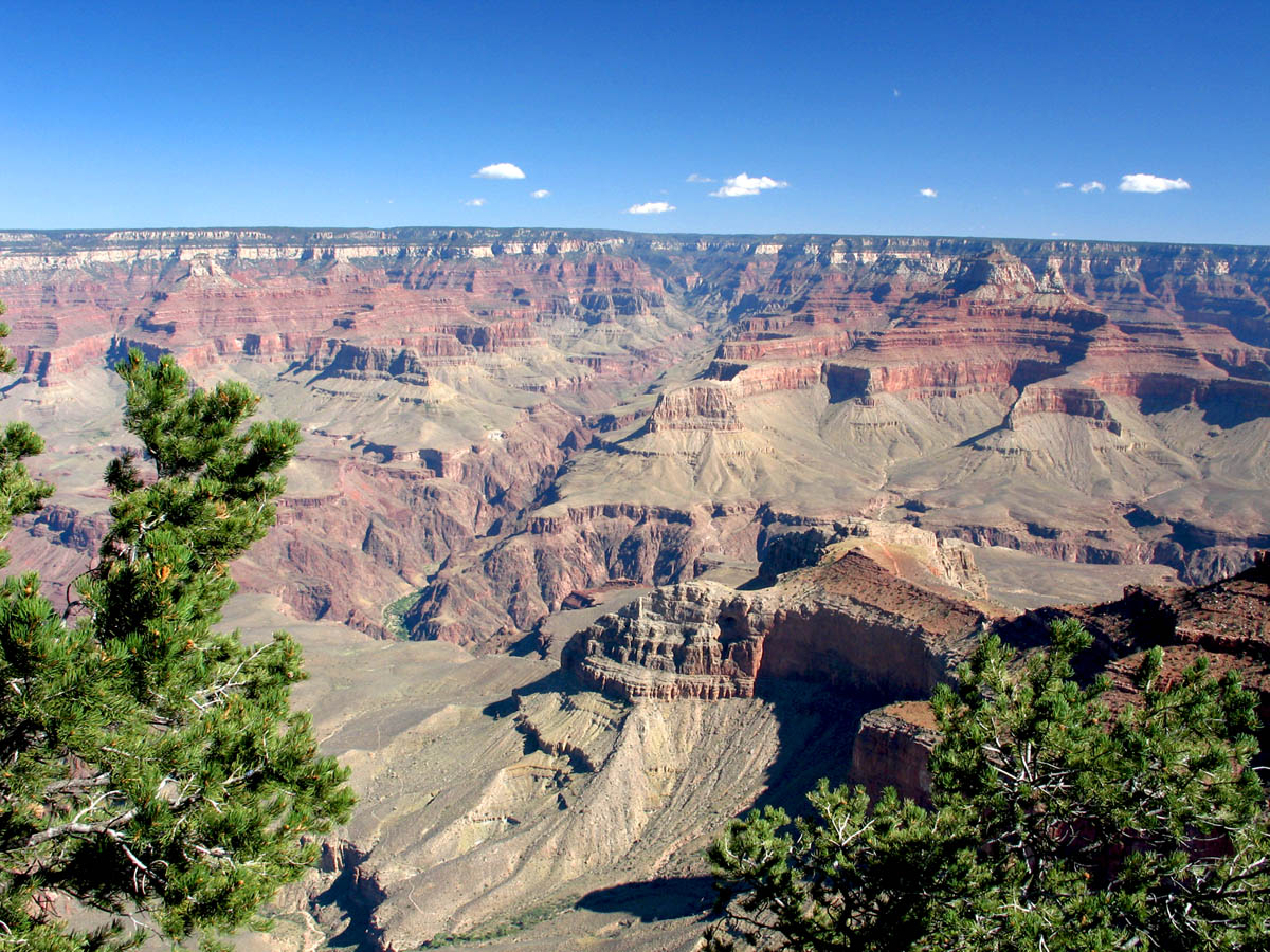
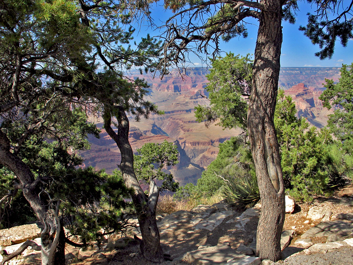
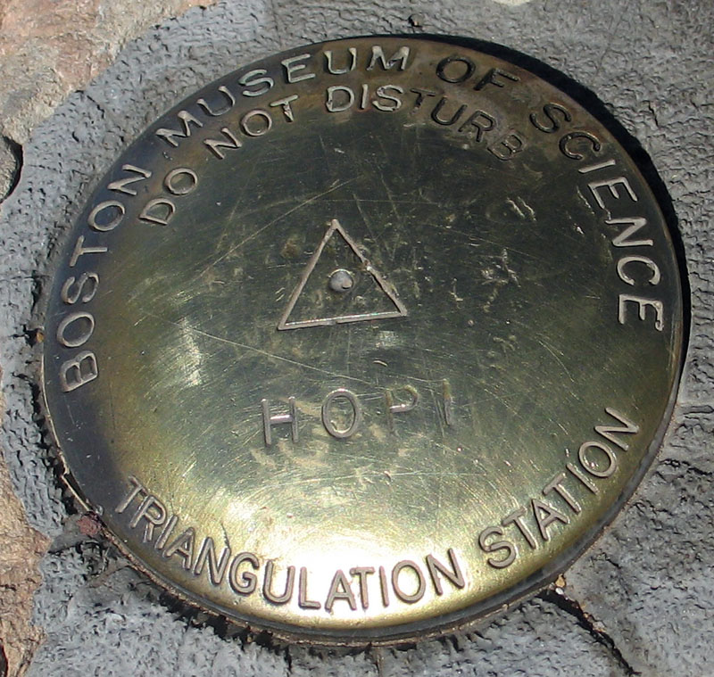
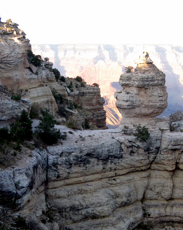
The Information Center is just that - the place you go for your introduction to the Grand Canyon. We checked out the times for the ranger programs - there was a "Geology of the Grand Canyon" program that started in about 20 minutes (at 10 a.m.) that we wanted to check out. I knew that one of the overlooks, Mather Point, was about 300 yards from the Information Center, so we decided to run down to it - we really needed to SEE the Grand Canyon before we learned about its geology.
And see it we did:
 |  |
| Mouseover the photo for a description; click for full version |
Let me see if I can recapture what I was thinking as I walked up to the Mather Point overlook – Vast. Muted. Big. Vast. Wide. IfIfalloffthisbitofrockIamstandingonIamsoSOdead. Vast.
The canyon really screws with your sense of perspective. When you look off into the distance, it seems two-dimensional. It also doesn't feel like you're looking at something real, or in real time – it seems like you're looking at a painting, or a colored pencil drawing of a scene.
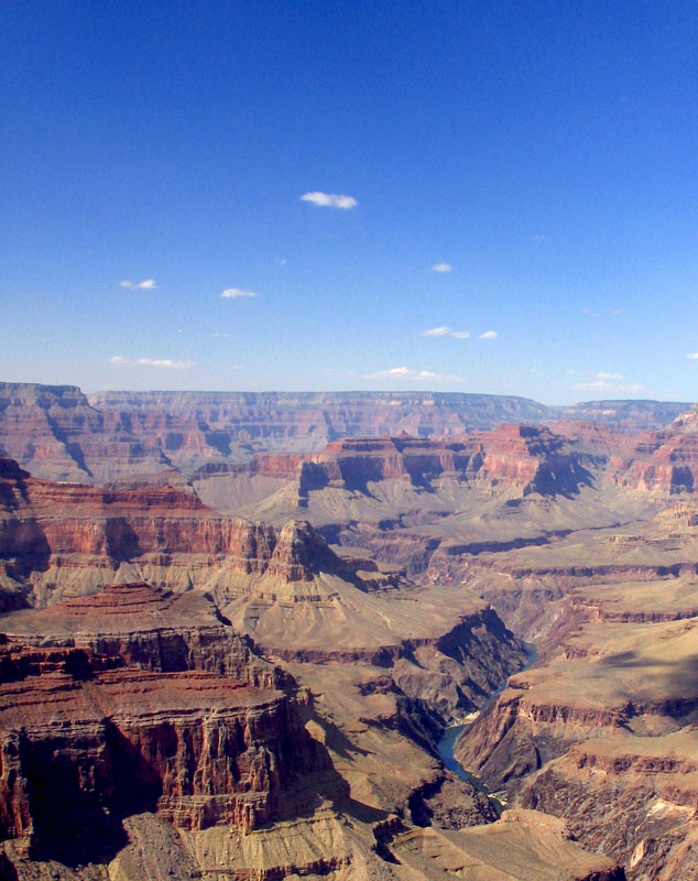
I was also quite struck by the fact that there were clouds in the distance that were at eye level. I found myself thinking about this a lot during this trip, because it's so unlike anything I've ever experienced. Having spent most of my life at sea level, clouds are things that are way, WAY up in the sky. But at the Grand Canyon (and especially at Sandia Peak in Albuquerque), it felt like I could reach out and touch one.
If my arms were 800 feet long.
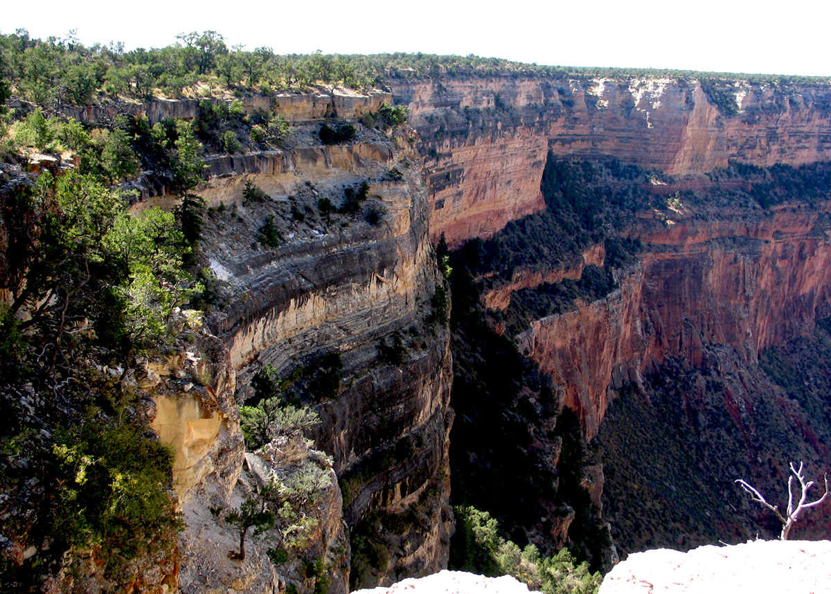
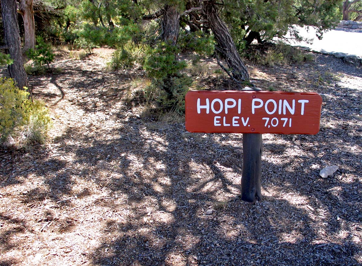
We hoofed it back to the Info Center to listen to Park Ranger Jeff give a talk about geology. It was a 45 minute program that should have been about 30. Trina and I were both wishing for it to end, and when it finally did we bailed for the shuttle bus so that we could make our way out to the stops along the Hermit Road View drive.
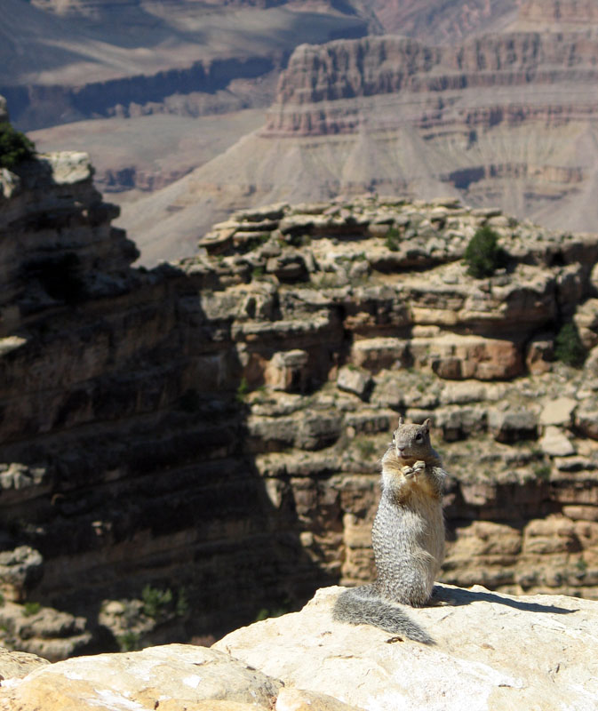
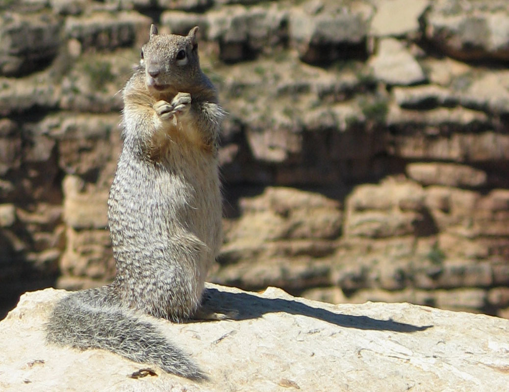
We spent about two hours on the Hermit Road stops, and the highlight for me – beyond the sheer magnificence of seeing the Grand Canyon from several different perspectives – was the cute little squirrel at Powell's Point.
Mo' photos!
 |  |  |
 |  |  |
 |  |  |
| Mouseover the photo for a description; click for full version |
I'm a sucker for squirrels, what can I say? And let's not ever mention again that I totally faceplanted at the Maricopa Point overlook while coming down the stairs. Fortunately my camera was in my right hand and I put out my left arm to catch myself.
On the ride back to the parking lot from Hermit's Rest, I had the honor of sitting in what we called the "jiggle seat" - the seat over the wheel well in the trailer that the shuttle bus was, uh, trailing. I was very happy to be wearing high-quality foundation garments during that bumpy 20 minute ride.
A Good Samaritan also saved me from decapitation by fixing the nameplate of the driver, which was about to fall off its place hanging directly above my head.
Next up was a park ranger talk at Yavapai Observation Point. The topic was the "Changing Geology of the Canyon" (again with the geology!) but THIS TIME we had a wonderful ranger, Ranger Matt. Or "Matty," as I referred to him in my head.
Matty was of the *swoon*.
Ranger Matthew was in his mid-20s, and he had long blonde hair pulled back into a ponytail and he was wearing the most adorable park ranger hat. It was LOVE, I tell you. He was demonstrative and fun and excitable. Everything I like in a man.
*swoon*
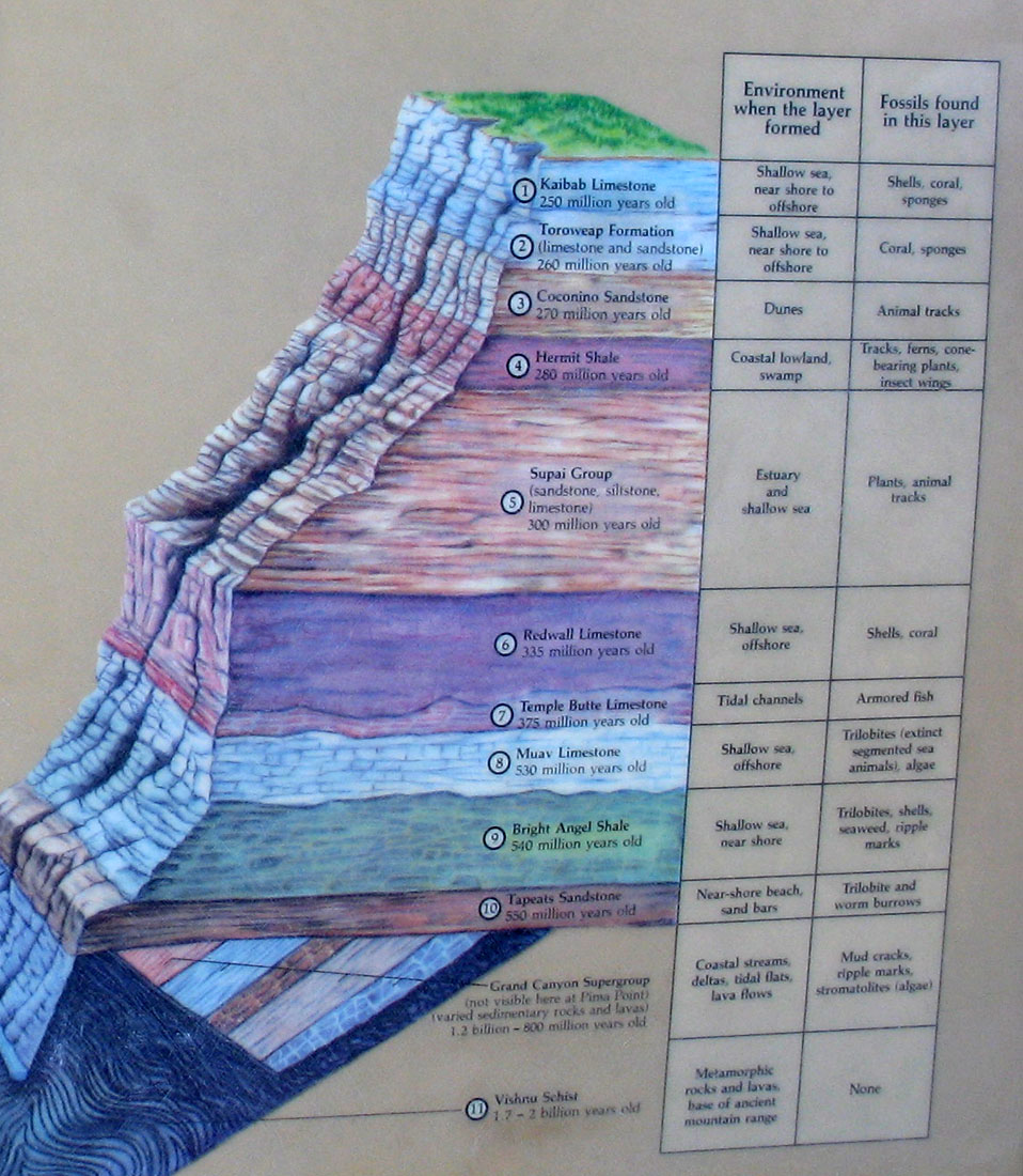
Matty taught us quite a bit about the Canyon, and I actually retained the knowledge for at least two weeks. Had I written about this day (October 3) sooner than October 26, I'd have been able to quote chapter and verse about the water quality of the Colorado River, endangered birds and shrubs, dump trucks, dams and plate tectonics.
As it is, I can tell you that the canyon's breadth is a factor of water erosion (rainfall) over g'billions of years, and rivers are often strong enough to move big huge boulders (another factor in the canyon's formation).
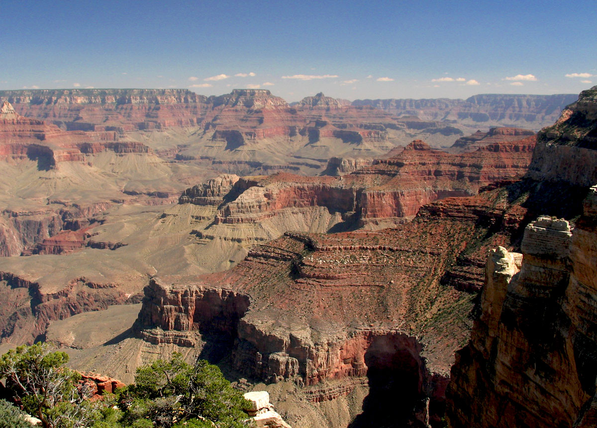
From there we walked back to Market Plaza. We got the car, stopped for a late lunch at the cafeteria, wrote out and mailed postcards, then drove ourselves out on Desert View Trail. We were trying to make it to Lipan Point for the sunset. Which we did:
 |  |  |
| Mouseover the photo for a description; click for full version |
Again, I was a bit underwhelmed by the sunset. It wasn't quite as brilliant as I was expecting.
And then we left the Grand Canyon, driving east on 64. It was a gorgeous night; we really loved having the convertible at this point. We listened to Smokey Robinson & The Miracles, and the Beatles "red" album on our drive down to Winslow.
Winslow is where we ran into a bit of difficulty. It was about 9:30 or so by the time we got there. We were following the directions on the AAA guidebook to find La Posada. We were on 2nd Street, which was supposed to be Route 66, but it looked a little ... rustic ... right off the interstate.
Me: "I don't think we're in downtown."
Trina: "I think we're in SKETCHVILLE."
I don't know why, but that comment made me laugh so hard that tears were streaming down my face. Probably because it was the end of a long, satisfying day, but ... yeah. Very funny in the moment.
So, just like in Sedona, we turned around and headed back from whence we came. And ran straight into Mike's Pike (or rather, "Mikes's Pike" - I can't decide if the person meant it to read that way, or if they were just illiterate).
But eventually we found La Posada - we just hadn't driven far enough on 2nd Street - and after wrestling with the car lights for 20 minutes (more on that in Day Four), we collapsed into bed.
October 12, 2005
Roadtrip '05 - Day Two - Sedona
So we awaken in the sleepy little town of Cottonwood, Arizona. I slept like a rock, go figure.
Our first order of business was breakfast, and the goal was to go to the Coffee Pot Restaurant, home of 101 omelettes. We took off and headed north to Sedona.
On the way there, we saw a sign for Crescent Moon Ranch and saw the famous Cathedral Rock in the distance, so we turned off of 179 and drove down a steep, winding road towards the rock. But it was still hazy that morning (it was about 8:30 a.m.) and I knew that wouldn't be good for photography. So we stopped midway down the road and turned around, resuming the drive towards Sedona proper.
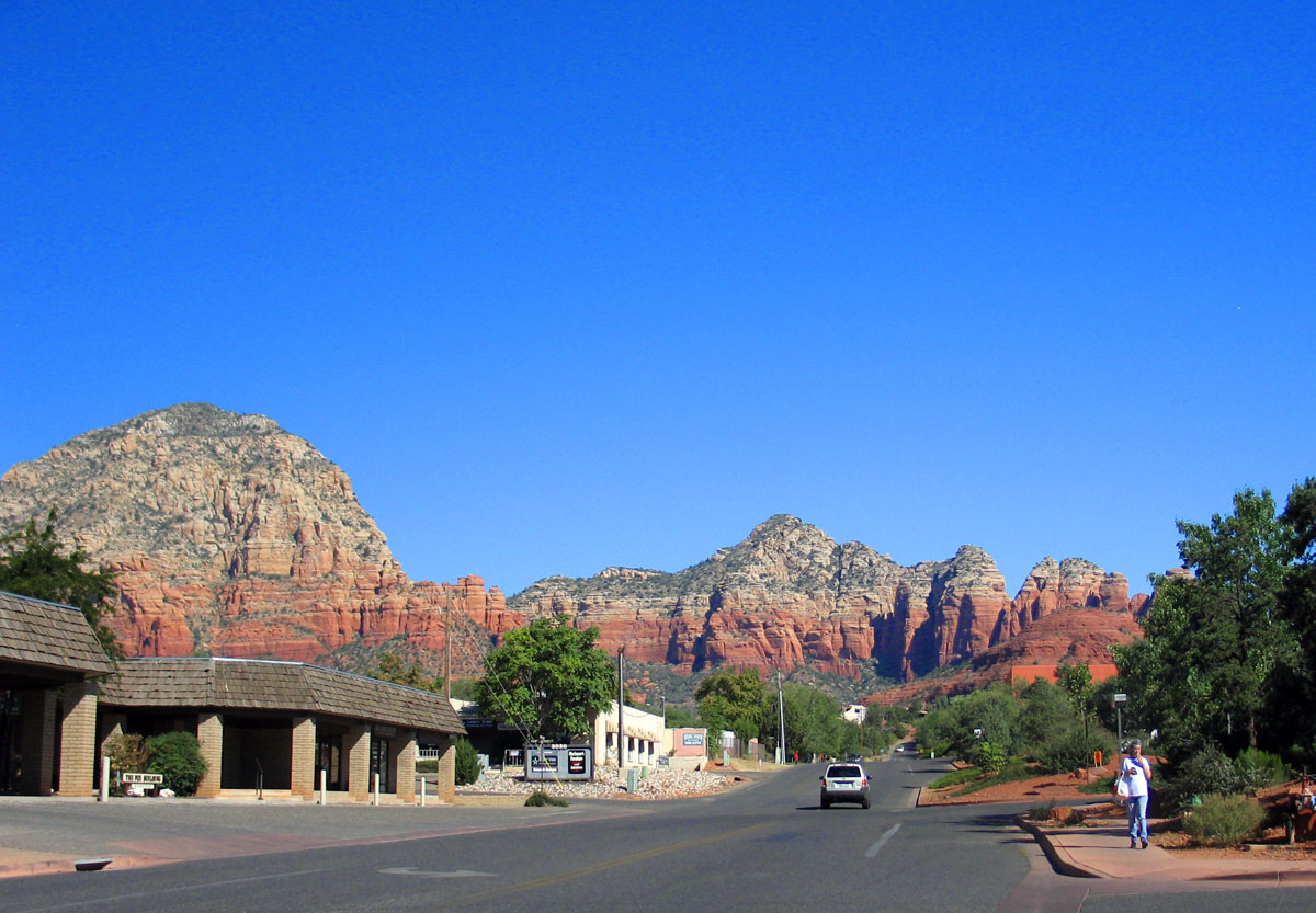
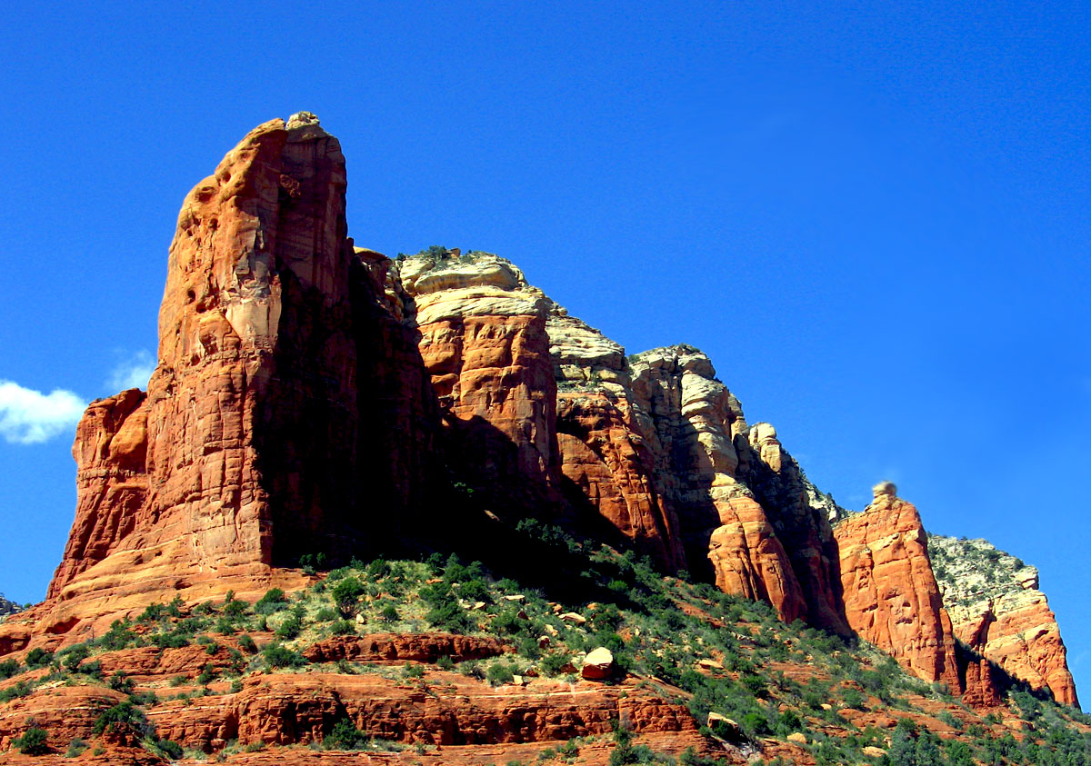
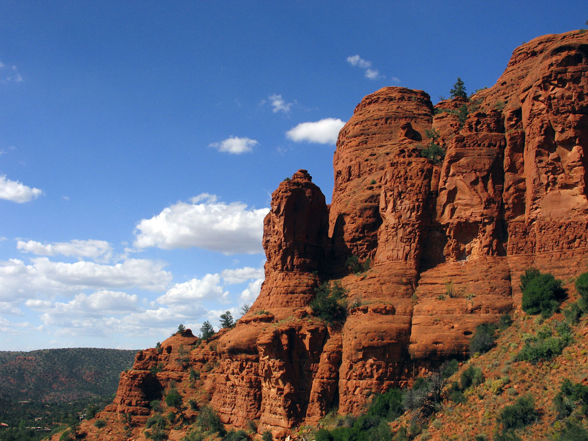
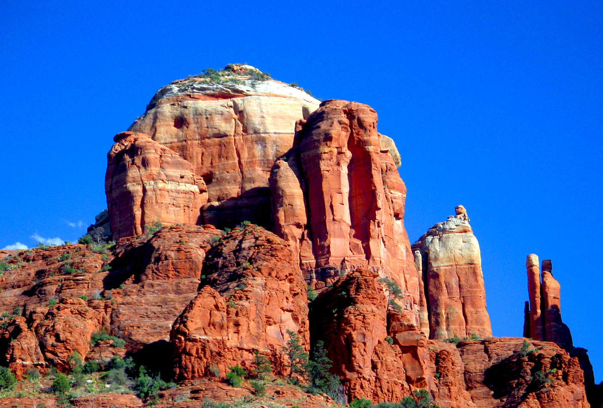
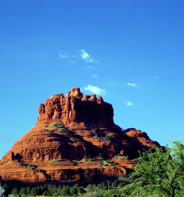
The scenery was breathtaking. I had expected on this trip to be blown away by the Grand Canyon, but I didn't expect to stand there, awestruck, looking at the red rocks scattered in and around Sedona. The colors were just gorgeous. Every time we'd get out of the car, we'd turn around and the skyline would be filled with a sight such as this:

Everywhere we went in Sedona, that's the kind of thing we saw.
But I digress. Breakfast - or rather, mass quantities of food - was on our mind. We found the Coffee Pot Restaurant, but it was packed, so we drove another few blocks to the Sedona Visitors Center. It was closed until 9 a.m. (we were 15 minutes off), so we went back to the Coffee Pot and waited.
They get people in and out quickly, so our wait was only about 10 minutes. And we were lucky enough to get seated out on the garden patio, which was very nice. It wasn't cool - the temperature was probably in the low 70s - but it was comfortable.
The restaurant does, in fact, offer 101 different omelettes. Trina ordered one with spinach, mushrooms and a side of salsa. Mine had spicy ground beef, cheese, salsa and onions. I also got the grits (yum!), hashbrowns, and toast. Hello, starches! Trina got the hashbrowns and biscuit. I tried four different types of jam/jelly (boysenberry, blackberry, strawberry, and grape) on the toast, and only ate half of the grits (tasty, but filling), but ate every last morsel of the omelette.
And then Trina and I rolled ourselves out of the restaurant and collapsed into the car.
We headed back to the Vistors Center, where I picked up about 20 different brochures. My packrat tendencies follow me everywhere, as does my love of FREE STUFF. Inside the center I talked to a kindly, old (and apparently drunk) woman who mapped out a "scenic driving tour" of Sedona on a printed map. She started drawing what I thought were boobs - two circles with dots in the middle - but then she added eyebrows and a smiley mouth and I breathed a sigh of relief.
But I still maintain that she was three sheets to the wind at 10 a.m.
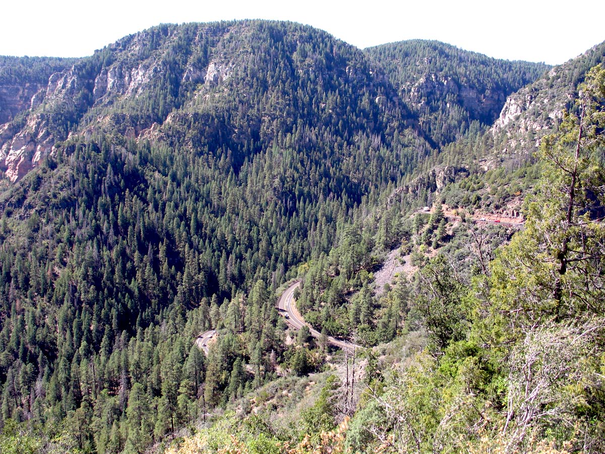
Driving map in tow, I skipped back out to the car and we decided, what the hell, let's drive up Oak Creek Canyon right now. This was one of the expected highlights of the trip - Oak Creek Canyon has been named the most scenic drive in the U.S., and I had heard a lot about the switchbacks and how you gain several thousand feet in elevation over only a few miles. So I was totally jazzed to go on this drive.
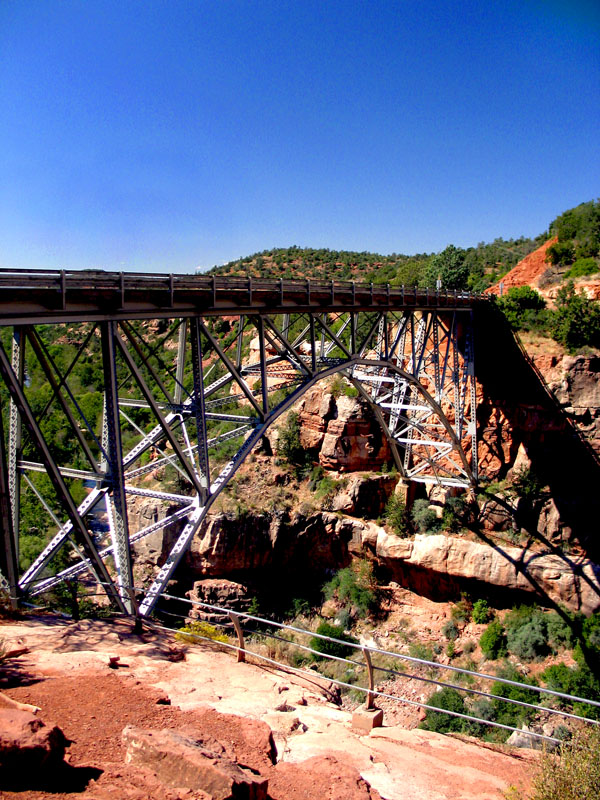
There are several scenic outlooks along the way. Our first stop was Midgely Bridge (or as the defaced sign read, "Midgely Bridgely"), an old trestle bridge.
We stopped at a few other scenic outlooks, but it was the switchbacks that held all of our attention and required total concentration. This road, Oak Creek Canyon, basically winds around on itself up a mountain. So what happens is that you start making U-turns on the road as it swerves back and forth, gaining elevation. The posted warning signs recommended taking these curves at 15 mph, but even that seemed like it was too fast to handle the sharpness of the turns.
At one point we were looking north and I saw what looked like cars driving halfway up the mountain ahead. I remember saying to Trina, "I wonder how they got up there."
The switchbacks is how they got up there. We were about to drive up the side of that mountain ourselves.
It took about 15 minutes, but we finally reached the top - the Oak Creek Vista.
| 
| 
|
| Mouseover the photo for a description; click for full version |
Then it was my turn to drive down the canyon, and it was a blast. Kind of nerve wracking, but fun nonetheless. I can't imagine driving it in the dark, though. Trina and I decided we wanted to avoid that at all costs, and planned to get to Flagstaff that night by driving south out of Sedona and then picking up I-17 heading north. It was about 20 miles out of the way, but it felt a lot safer to go that route rather than try to manuever through those switchbacks in the blackest black of night.
But for now, we were going back to Sedona to continue our Drunk Grandma's Scenic Driving Tour. On the way down we pulled off to the side of the road so I could take a photo of the outside of Slide Rock State Park. It was funny - I'd get all excited by these views of huge red rocks and mountains, and want to take photos of them, and then a half hour later I'd see something even better and prettier. I had 10-20 photos taken from the road of mountains in the distance - I ended up deleting them all because, well, I ended up getting right next to those mountains and taking much more impressive photos of them.
After Slide Rock State Park, we got back into the city and headed west towards Coffee Pot Rock. It was a gorgeous day - clear blue skies, scattered clouds, temperatures in the high 70s. Perfect convertible weather. Both Trina and I were amazed for some reason by the fact that there were houses practically across the street from these huge, historic red rocks. I don't know why that threw us off, really. I guess we both expected these landmarks to be in state parks or something.
We drove just about to the base of Coffee Pot Rock.
We continued our scenic drive to Boynton Canyon, but didn't see much. Mainly because we had not purchased a Red Rocks Pass that would have allowed us to park at various places. Granted, eventually we illegally parked in some of these places anyway, but at this point we were still being good children.
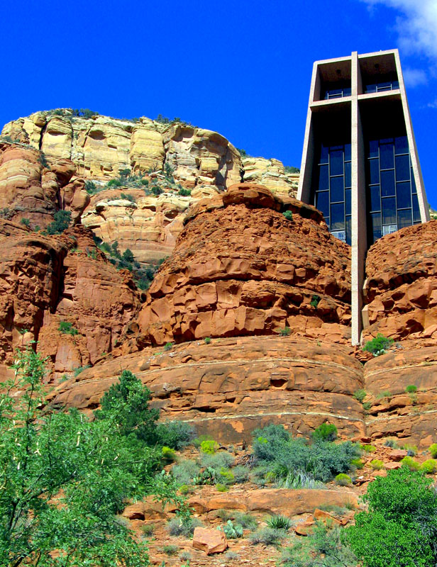
We headed east towards the Chapel of the Holy Cross. To illustrate my cluelessness - I didn't realize it was a Catholic church until we got into the chapel itself and I saw people crossing themselves and anointing themselves with holy water.
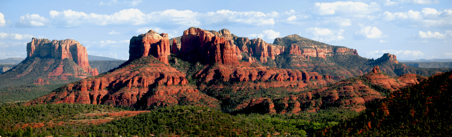
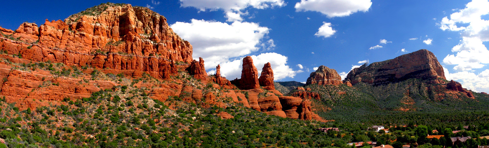
Anyway, we sat for a few minutes in the chapel in quiet reflection, but skipped the gift shop downstairs. I think both of us were more interested in the views surrounding the chapel. We went back outside and just milled around with all the other tourists (I heard Japanese, French, Spanish, German and what sounded like Croatian being spoken). I took the photos that make up the panorama that is in the beginning of this entry, as well as about 60-70 others. Here are the best (and a little panoramic video):
 |  |  |
| Mouseover the photo for a description; click for full version |
 Panoramic view surrounding the Chapel of the Holy Cross (AVI, 11 MB)
It was now midafternoon, and we weren't super hungry but wanted something to eat. So we found an ice cream shop in the Sedona Center shopping area. Trina opted for mint chocolate chip, and I choose a refreshing raspberry sorbet. I called my mom to check in on my cats while meandering through a gift shop looking for a souvenir for my nephew, Alex. I didn't find anything good, so we left and headed south again for our second try at viewing Cathedral Rock.
This time we drove all the way to the end of the road, which led us to Crescent Moon Ranch. We debated spending the $7 entrance fee, then decided to go for it. We parked and then headed in the direction of Cathedral Rock, which we could clearly see in the distance.
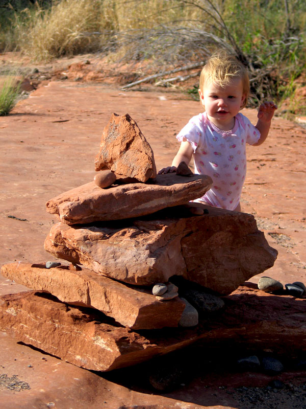
The paved trail let to a wooded area, and we ran into a few families who were swimming in Oak Creek. We kept going on the now unpaved trail and found ourselves walking over a rocky landscape as the Cathedral loomed in the distance (this is where I met an adorable little girl named Andi). We went as far as we could towards the rock, but Oak Creek stopped us.
We kicked off our shoes and sat dangling our feet in the creek for 15-20 minutes, just enjoying the scenery. Which, again, was breathtaking. We debated wading into the creek but decided it was too deep. So then we headed back, but we got a little adventurous by breaking off the trail and hiking into the Coconino Forest a little bit. We still had our shoes off, and between the sticks on the ground and the rocks in the creek itself, we both killed the bottom of our feet.
We made it back out to the park restrooms (which, strangely, didn't have sinks). There was a spigot outside that we had planned to use to wash off our muddied feet, but it didn't work. I brushed off the red clay as best as I could, but now I have a pair of red clay-stained socks.
 |  |  |
| Mouseover the photo for a description; click for full version |
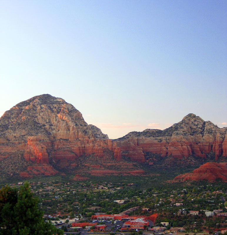
We left the Crescent Moon area and headed out, stopping along the way to take some more photos of Cathedral Rock (this was when I took the shots that make up my Cathedral Rock panorama). It was getting close to sunset, so we drove to the Sedona Airport, since I had read - and Drunk Grandma confirmed - that the Airport Mesa is the place to be to watch the sun go down.
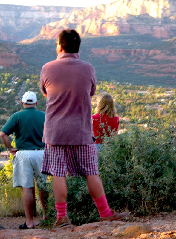
We got there about an hour before sunset and the place was already filling up. Trina and I parked our butts in a place with a good westernly view, and from then on we were treated to the melodious conversation - overheard because it was SO FREAKING LOUD - being led by Mark from Pittsburgh.
Mark from Pittsburgh had a mullet. I could probably stop with my description right there, but no, I will go on. Mark from Pittsburgh was a staunch Republican who haaaaaaated the Clintons, yet had many, many close friends who actually worked for the Clintons when Bill was the governor of Arkansas. Mark from Pittsburgh (I need a macro) invited Bill and Hil to his birthday party one year, but they declined.
I was trying to tune Mark from Pittsburgh out, but it was impossible. He was regaling anyone who had the misfortune to be near him with stories of his success at calling into radio shows. IN FACT, Mark from Pittsburgh has been on a radio show NINE TIMES in his life. NINE TIMES, my friends. Stop clutching your pearls.
I could have sworn I heard Mark from Pittsburgh say, "I do heroin," but when I checked with Trina she said that it was actually "I do hair." Mark from Pittsburgh - Republican gadfly and all around pompous ass - was a hairdresser.
And then he proceeded to wax poetic about the various ways to make hair stay in one place. My eyes glazed over. Trina asked me if I thought offering him $20 to STFU would work. I was pretty sure it wouldn't, but I dared her to go through with it anyway. And then ...
... we just sat there and mocked him behind his back. Cowards, one and all!
The sunset was rather meh. I got more entertainment out of the hot pink socks (and boxer shorts) being worn by a fellow tourist:
 |  |  |
| Mouseover the photo for a description; click for full version |
We had dinner at a Mexican restaurant recommended by Mike called Oaxaca, where we sat on the rooftop cantina and enjoyed the view while scarfing down two bowls of chips and salsa. I had the pollo fundido and Trina had the posole.
Then it was time to hit the road again, so we headed south away from the scary, scary Oak Creek Canyon road and picked up I-17 heading north to Flagstaff. We arrived in Flagstaff late and checked into the Days Inn 66 (on Route! 66, of course). Trina was in bed and asleep within 15 minutes of stepping into the room. I took a shower, so I was asleep within 25 minutes.
October 10, 2005
Roadtrip '05 - Day One - Phoenix
The trip to Arizona began inauspiciously enough. Trina and I awoke on time, got out of my apartment on time, but then we hit every. single. traffic light. on the way to Tampa International Airport. We parked in the remote economy lot ($42 a week!) and then caught the shuttle bus to the terminal.
Frontier Airlines ticket counter - mostly deserted. There was a family in front of us - dad, toddler, mom with a baby strapped to her chest like some sort of maternal terrorist bomber, and a yellow labrador retriever in a gigantic crate - lugging a huge cart full of suitcases to Denver.
A very strange older women wearing too little in the way of clothing - tank tops are not for 60 year olds - approached Trina and asked if she (the woman) was "standing in the right line." Trina's response was something along the lines of "how should I know?" It was before 8 a.m., the woman was odd - crankiness can be excused.
We got our boarding passes, trudged out to the gate, and flew from Tampa to Denver, Colorado. I had the window seat; Trina lucked out (heh) and sat in the middle seat beside a kindly old grandmother that would not leave her alone. This is why I feign sleep on flights - so I don't have to make conversation if I don't want to.
The grandmother liked Trina so much that she gave her a hug when we deplaned in Denver.
After a 45-minute layover (during which time I bought a Colorado magnet), we were on our way to Phoenix. That leg of the journey was nondescript. We landed, grabbed our bags, then hoofed it over to the Dollar Rent-a-Car desk to pick up our sweet little convertible.
*screeching car brake noises*
Except Dollar didn't have our convertible. The unhelpful counter boy offered to give us a PT Cruiser convertible. I glared at him, knowing there's no way we'd be able to fit both bags in the trunk of a PT Cruiser convertible. I wanted my Chrysler Sebring convertible, dammit! Sadly, the unsightly counter boy had given it to the last customer, despite our having a reservation for it.
Much glaring ensued. In response to the glaring, the unholy counter boy ran over to the Avis counter to ask if they had any convertibles available (they did) and would they match the quoted price we had from Dollar (they would).
So Avis hooked us up with (what we thought was) a sweet li'l Chrysler Sebring convertible. The Avis shuttle bus picked up outside the terminal, so we hauled ass outside to wait.
Now, let's talk about heat. People always say that Phoenix is a "dry heat," as if the temperature being in the triple digits is an afterthought. Dry heat doesn't feel as hot, they say.
LIES! ALL LIES!!
It was mothrafocking HOT in Phoenix. I wanted to drop to the ground and make sizzling noises, that's how hot it was. And it felt every bit the 101 degrees that it was. The only difference between Phoenix heat and Florida heat is that in Florida, you steam. In Phoenix, you roast.
Two different cooking methods, but they're both still damn hot.
We got out to the Avis lot and picked up the car. It was a two-door Sebring in a charcoal gray color. Very pretty. And it would have been a very nice car except for the fact that we thought we were getting a FOUR door. The trunk of the two door? Not big enough to hold both suitcases.
I shoved my bag in the practically nonexistent back seat. Within minutes we had figured out how to lower the top on the Sebring (despite having no owner's manual to consult - Trina and I are just that smart), but it was TOO FREAKING HOT to actually leave it down.
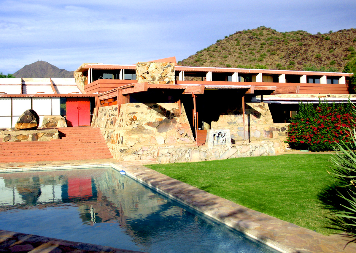
So then, we're off! To drive through beautiful downtown Phoenix. I think we were on the 202 loop. Or maybe it was the 101 loop. Regardless, we were heading towards Scottsdale, because we had a 4 p.m. tour to catch at Frank Lloyd Wright's winter home, Taliesin West.
But it was only 2 p.m., and we were starving (we had not had lunch), so we whipped open the AAA Tour Book and picked a restaurant near Taliesin West called NoRTH. It was billed as "contemporary Italian" and we found it in an upscale little shopping center (the name of which I cannot remember). We sat, and were served by Dan. Dan is now my best friend (you'll see why in a minute).
We both had sandwiches. Trina ordered the grilled flank steak, and I choose the flattened chicken with smoked provalone and sauteed spinach. They were huge, and amazingly good. But the best part of lunch was this side salad that came with the order - it was a cold salad made of couscous, golden raisins, a spicy-sweet vinaigrette, and some other ingredient that neither Trina nor I could place. We asked Dan what it was - turns out it was figs.
FIGS. I ate figs, and liked it. I also ate golden raisins - I hate raisins - and liked them, too. This side dish was that good. There was also a side of cold roasted veggies tossed in another vinaigrette, which was a shade less outstanding than the couscous dish, but still excellent.
I cleaned my plate. As I said - starving. Then I asked Dan if he knew where the nearest Target was located. I explained that we were on a roadtrip and needed some supplies (bottled water, snacks, candy). Dan said "one minute" and ran off. I assumed he was going to go ask one of the girl waitresses where the Target was - we girls always know exactly where the nearest Target is. Instead, Dan came back with a piece of paper and a pen and proceeded to draw me a map that showed how to get to Target.
I love you, Dan!
We settled the check, Dan invited us to stop in and see him on our way out of the state (which we didn't do), and then we were off. Well, first we went across the street to a two-story Barnes and Noble to pick up some reading material (a book on Watergate for Trina, some magazines for me), and THEN it was off to Taliesin West.
I'm not an architecture geek or anything, but Taliesin West was REALLY interesting. We had a great tour guide (Greg) who made the 90-minute walk through the grounds very engaging. These are the best of the photos I took:
 |  |
 |
 | 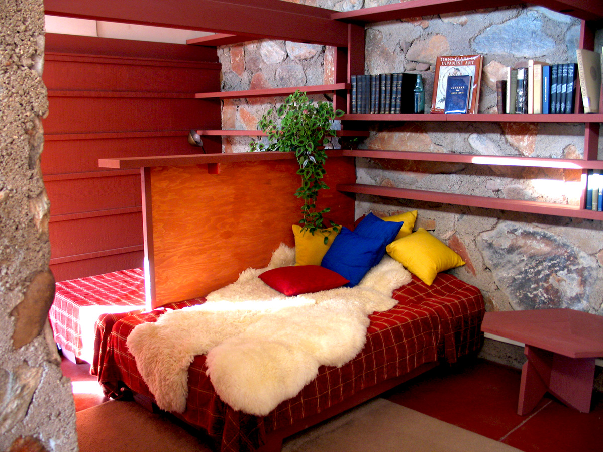 |  |
 |  |  |
| Mouseover the photo for a description; click for full version |
Taliesin West is also where we first saw the saguaro cactuses. I wanted to run up and hug one, but Trina advised against it. We bought magnets at the gift shop, then departed. As we drove out, we passed a neighborhood of houses, which elicited the response from me that "it looks like God vomitted upon the hillside."
Yeah, we didn't really like Phoenix for whatever reason. At least the parts we saw. I did catch a glimpse of an In-and-Out Burger and made a mental note to go to it when we were back in town in a week, but never ended up making it there.
In fact, I think the best part of Phoenix for me was seeing a sign on the interstate for Los Angeles. That just seemed really amusing to me (since, being from Florida, Los Angeles seems like it's hell and gone).
At Target we bought supplies - bottled water, peanut butter crackers, Dove cookies, Twizzlers, SweeTarts (yes, we bought crap) and Honey Nut Cherrios. I also picked up some socks and a jaunty little newsboy cap (in dark brown suede) to wear in the car when we had the top down (to keep my hair from whipping around all willy-nilly).
Fun fact - I look like a total dork in hats. I have a ginormous head (well, not really) and hats never fit right, so they never look right, and I end up looking like the idiot girl who rides the short bus wearing a helmet and spontaneously licking the windows. Consequently, there are no photos of me wearing said newsboy cap, so don't even ask.
We got out of Target around 8 and it was finally cool(ish) enough to put the top down for our drive to Sedona. We planned on staying there overnight so we could get an early start on seeing the red rocks the next morning. We took I-17 north, and about 30 miles outside of Phoenix it got a lot cooler. That night drive was a lot of fun - I was riding shotgun, and I'd look up and see not only the stars, but the stardust surrounding them. You never see that in this area of Florida; there's just too much ambient light.
It was beautiful, and it made me smile every time I looked up.
Another fun fact - the speed limit on I-17 is 75 mph. However, the state of Arizona is nice enough to warn you that there are certain curves on the interstate where you need to slow down in order to negotiate the curve safely. Signs like this one, only in Arizona the speed with which you should take the curve is posted underneath the black arrow. On I-17, you need to slow down to ... 70 mph.
Speed limit? 75. Speed limit on the curve? 70. SEVENTY MILES AN HOUR, Jimmy! And not one mile per hour over, or else you're taking your life into your own hands.
So we made it to Sedona that night. Or so we thought. We saw signs for Oak Creek Village and that seemed like it was part of Sedona, so we parked in the lot at the La Quinta and made calls trying to find a room for the night. The La Quinta parking lot was not full, but when we called the Sedona La Quinta they said they had no vacancies. The other reasonably-priced accomodations we called in Sedona were full, too.
I began to suspect we might not be in the right place. We were on SR 89 at this point, and I was trying to find where this road intersected with 179. So we drove north a little ways, but the road kept getting steeper and turning wildly, and it was pitch black at this point and the driving was scary.
We turned back, went back to the La Quinta parking lot (stupidly didn't go in), and called hotels in the city we had passed on the way to Sedona (Cottonwood). We booked a room at the Budget Inn and Suites, then backtracked a good 20 miles to get back to Cottonwood. By this time we were both ready to drop. I think we got into the room and were both in bed and asleep less than 30 minutes later.
Not going far enough would be a theme repeated later on in the roadtrip.
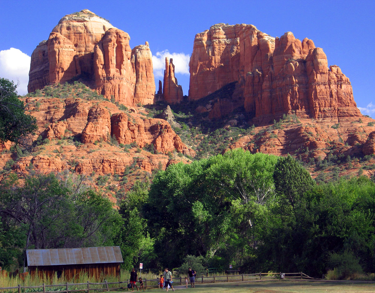
Cathedral Rock Panorama

The title is pretty self-explanatory - this is a panorama of Cathedral Rock (in the middle of the photo) in Sedona, Arizona. This was taken from an overlook outside of the Red Rock Crossing in the Crescent Moon Ranch area (or something, it's all running together at this point).
October 09, 2005
I Have Returned
I am exhausted.
We got home last night close to midnight, and so far today I have done nothing of consequence except watch TV. I had a fantastic week in the southwest, though. The highlights were Sedona (pictured above is a panorama of the rocks behind the Chapel of the Holy Cross - click for a larger image), the Grand Canyon, and Canyon de Chelly. Lowlights were the food in Chinle, the weather in Albuquerque, and our love/hate relationship with the convertible Chrysler Sebring.
I took 500 photos. Prepare for an onslaught in the next few days.
It's damn good to be home, though. I really missed my bed (oh, and my people and pets, too).
September 23, 2005
Life Is a Highway(girl)
Seven more days until I leave for Arizona. I'm getting a little bit nervous because Trina and I have made a conscious decision not to overplan this trip. Or to even really plan at all. We have a basic idea of what we want to do every day, but we haven't made hardly any reservations for things (other than a Navajo-guided tour of Canyon de Chelly on 10/5 and a hotel reservation for the one night we're staying in Albuquerque).
Aaaaaaaaaaand that's it. We've got a AAA guidebook flagged with potential motels. Our goal is to get as close to our next day's destination as possible, that's why we're not making reservations for lodging. Although now it occurs to me that I probably should have looked into making a firm reservation for the night I know we'll be in Flagstaff.
Oh well! Worst case scenario, we'll find an IHOP or all-night diner and sleep in the booths.
By the way - I won't be able to post here while on the trip (at least I don't think I will be, since I'm not going to purposely visit any internet cafés). HOWEVER, I have decided to dust off my Audioblogger account, so I will be posting short (four minutes or less) audio recaps over on my Fancy a Shag? blog.
There's nothing there right now, but if Audioblogger works the way it's supposed to, every day (or maybe several times a day) an mp3 of me talking about the stupid things I'm doing to embarrass myself and Trina will be posted on the site. You'll have to go by the dates/times to know if anything is new, because I won't be able to add titles on any of the posts.
It should be fun, though. Hopefully Trina doesn't look at me like I'm a complete dork for doing this. I do think, in addition to the metric ass-ton [TM Benhameen] of photographs I plan to take, that this will be a fun way to document my trip for posterity.
August 05, 2005
Road Trip '05 - Lost in Arizona
The plane ticket for Arizona, she is bought. Trina and I will be spending October 1-8 out West, taking in such sights as Taliesin West, the Grand Canyon, the red rock hills of Sedona, the Navajo-guided tour of Canyon de Chelly, and Sandia Peak in Albuquerque, New Mexico. In between all those things we'll be tooling around Route 66 in a convertible, eating at roadside diners, and stopping in whatever city we end up in for the night.
Trina's goal is to find the best locally-owned ice cream parlor every night, and partake of their wares. Ice cream on a daily basis? I can get behind that (although I made the qualification that milkshakes, malts, and other desserts are also included).
We've made no reservations for anything except the Navajo tour and our hotel in Albuquerque (the Balloon Festival will be in town while we're there, so lodging is scarce and expensive). This road trip is almost completely free form, which is exciting.
I've started buying stuff for the trip, which is fun (an excuse to go shopping? I'm there!). I've ordered two Manhattan Portage messenger bags - the Europa in red and the Europa Deluxe in black. I'll only be keeping one of them; I kind of like the idea of the red, but seeing it in person is key.
June 04, 2005
Road Trip '05 - Itinerary
Trina was in town last night, so we had a slumber party. We ate dinner at Mama Fu, got dessert at Cold Stone Creamery, watched the season finale of Lost, and planned our roadtrip through Arizona/New Mexico.
I'm totally geeked about this trip, now.
We can get roundtrip airfare from Tampa to Phoenix for $250/each, and renting a convertible for a week is only going to cost $380. Gas is going to cost a nice little sum (we're estimating driving about 2,000 miles over the course of the week), but still - I'm going to be driving in a convertible on Route 66. How cool is that?
Here's our first attempt at an itinerary. If anyone is familiar with the area and can give me feedback on whether I'm attempting too much on any given day, please let me know.
Here goes:
DAY ONE - SATURDAY, OCTOBER 1
Arrive in Phoenix at 2:30 p.m. Get the rental, then take the rest of the afternoon to just drive around the area a bit before crashing at the Ramada Plaza Hotel at Metrocenter.
DAY TWO - SUNDAY, OCTOBER 2
Leave Phoenix and head to Sedona. Drive around, see stuff, then head up through Oak Creek Canyon to Flagstaff. See the sights around Flagstaff and stay there for the night.
DAY THREE - MONDAY, OCTOBER 3
Drive from Flagstaff to Kingman, then up to the Hoover Dam. End the day driving back to Kingman (Route 66!) and staying there overnight.
DAY FOUR - TUESDAY, OCTOBER 4
Drive from Kingman to the Grand Canyon; spend the afternoon at the canyon before taking Highway 180 (through the San Francisco Peaks) back down to Flagstaff and staying there overnight.
DAY FIVE - WEDNESDAY, OCTOBER 5
Head to Winslow in the morning (stopping at the Meteor Crater on the way), then on to the Petrified Forest/Painted Desert after lunch. MAYBE go up to Canyon de Chelly if we have time. We plan on staying the night somewhere out there (near the border), or perhaps try to make it to Gallup, NM.
DAY SIX - THURSDAY, OCTOBER 6
Drive to Albuquerque in the morning. Go to the Rio Grande Zoo, then head up to Sandia Peak to take the tram to the top and eat dinner/see the sunset at the restaurant up there. Stay in Albuquerque overnight.
DAY SEVEN - FRIDAY, OCTOBER 7
Leave Albuquerque and drive south on I-25 and pick up Highway 60 heading west. This will take us through several mountainous areas before we hit Eagar, AZ. Then we head south on 191, the Coronado Trail scenic route, down past Clifton, then pick up 70 heading west to Globe.
From here, depending on time (we need to get back to Phoenix at a decent hour), we're going to hit as many scenic drives as we can. At the very least we'll take 60 west and then pick up 88 south (Apache Trail historic road). Time permitting, we might make a jaunt north up 288 through the Sierra Ancha.
DAY EIGHT - SATURDAY, OCTOBER 8
Depart Phoenix at 11 a.m. Collapse from exhaustion on the plane.
May 22, 2005
Road Trip '05
So, the trip to Ireland in October is pretty much axed, for multiple reasons that are too long to go into right now (but encompass things like time for planning, the cost of airfare, and a general anxiety about international travel).
INSTEAD, the idea now is to go on a ... ROAD TRIP ... through the Southwest. Specifically Arizona, New Mexico, and maybe a bit of California. Of course, I'll have to be drunk or otherwise mentally altered to willingly step foot in California, so we'll see how that plays out.
We're planning on flying into either Phoenix or Albuquerque and renting a car for a week.
Definite items on the travel itinerary are the Grand Canyon (duh), Sedona (AZ), White Sands and Carlsbad Caverns (NM), driving on Route 66 somewhere, Four Corners, and wherever the Painted Desert is. Under consideration are Joshua Tree (CA) and San Diego (for a west coast sunset).
Other than those major things, I'm pretty clueless about what sights there are to see in this area, so anyone who has traveled in that area and has opinions on what to do/where to go, please share them.